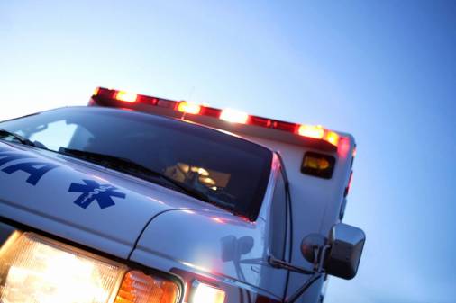
Winnipeg’s new traffic nerve center does ‘crazy things’

Just a three-hour drive north across the border from Grand Forks, North Dakota, lies Winnipeg, a Canadian city covered in snow one-third of the year, the birthplace of Neil Young, and now the home to one of the most advanced traffic monitoring systems in North America. When city leaders talk about the future of smart cities, automation and data-driven intelligence, it sounds a lot like what Winnipeg has already built with its Traffic Management Centre (TMC).
The sophistication of the center, which launched in January following a $3.6 million capital funding allocation in 2015, is not lost on the city, which calls it “a traffic nerve center” that provides to residents and city departments an “unprecedented” level of real-time roadway data and visual information. And though city officials report the situational awareness supplied by the network is already yielding improved traffic flows and new insights to improve city operations, they continue to pile on new features and data streams.
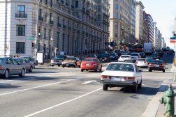
The center’s information system is fed real-time data from every traffic signal found in the city’s 650 intersections, each connected by LTE wireless. The 100 percent signal connectivity allows for remote timing changes that can be made within minutes, where previously it took days. More than 70 high-powered cameras allow city officials to verify the information they receive from its integrated systems, allowing for both an improvement in the quality of the data received and the inclusion of additional situational details that sensors alone can’t detect.
Lots of cities think they need to wait for fiber or 5G to launch a system like this, said Jonathan Foord, the city’s signal asset engineer, but LTE has provided Winnipeg the connectivity to launch its transportation monitoring network fast.
“Rather than looking at maybe $140 million for fiber costs and maybe at best 10 to 15 years to get the fiber rolled out, we were able to [connect our signals] in eight months for less than half a million dollars,” Foord said. “And now we’re doing crazy things.”
The details are in the data
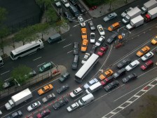
Potholes, debris, collisions, fallen trees, construction and anything else that might influence the flow of traffic is picked up by the city’s reporting system and validated manually via camera. The data is plotted to a graphical citywide map, alongside data from 311 calls, where it is then pushed out to anyone who might need to know exactly what the roads look like at any given moment.
“We’re trying to use the TMC to take things to the next level,” Foord said. “Rather than use cameras to identify incidents, we’re taking all the information we can grab throughout the city to bring that into a central system and verify that with our cameras and document all that information that we found out and disseminate that to service providers, and Waze, and social media, like Twitter.”
Dozens of city and municipal governments have joined the free Waze Connected Citizens Program since its launch in 2014, and Winnipeg is among them. But the highly detailed data the city is now collecting is allowing a level of reporting to citizens that Foord says he hasn’t seen anywhere else.
“It will just say ‘construction, water main.’ Or, ‘construction, gas,'” Foord said of the data commonly made available in most Waze partner cities. “It really doesn’t give you any more information. But if you come to Winnipeg, you’ll see ‘construction, southbound, keep left’ and there’s different information provided lane by lane.”
The city also now working to include data on its more than 250 rail crossings via Waze. This is especially challenging, Foord said, because the railways were there first and so there is a tradition of rail authorities not needing to report any information to the city about their operations. A local company called Trainfo is helping to solve this problem by installing sensors near the crossings and reporting out in its app when the trains are expected to cross and how long it will take to be clear of the road. Data for 30 of the city’s busiest rail crossings is expected to be reported directly to Waze within a year, Foord said.
The reach of the city’s traffic cameras adds a prodigious wrinkle to the center’s capabilities. More than 70 cameras allow active 360-degree monitoring of about 30 percent of the city’s regional roadways. A single camera can zoom in to view incidents that are more than two miles away.
Blanketing a city with such powerful cameras would be sure to raise eyebrows in cities in the U.S., and addressing privacy issues in Canada takes a similar form, Foord said. In addition to community engagement, city government also takes proactive measures against abuse of the technology by officials. When cameras are aimed at certain coordinates and reach designated zoom levels, the image is blacked out, thereby preventing accidental or purposeful glimpses into a bedroom windows or backyard pools.
Enterprise operations
The risk of privacy invasion is being weighed against the new capabilities and efficiencies the city is now gaining across agencies. Power outages will be reported to utilities faster, because they will be detected and confirmed faster. Traffic signal malfunctions are fixed 30 to 40 minutes faster than previously, Foord said. And the city’s emergency response teams are gaining new intelligence and lead time as they respond to incidents. Making all this possible required “an enterprise view” of the data, Foord said.
“Traditionally, a lot of things come to the TMC and kind of die there,” he said. “Really what we’re doing is saying, ‘Here’s a model that information can be shared throughout the city that other people can actually interact with other incidents and provide information and updates and collaborate.’ But then that video can also be shared to users who have different permission levels to gain control or view live or recorded video and then the same thing with the data.”
This new ability to share data across the enterprise is transforming how the city works. Previously, fire trucks were dispatched with a printout from the 911 center that contained information on where the incident was located and just “a few bits” of information, Foord said. But now first responders are privy to a dynamic view of the roadways, with information about road closures, events and recent outages that could effect travel times. Soon, Foord said, first responders will literally have a view of the roadway and the incident they’re approaching, with real-time access to the city’s cameras.
Eventually, the city hopes to automate the inclusion of new reports, Foord added, so new intelligence can be added to the map even faster. They’re also working with several agencies, he said, to integrate new data streams into the system so the city can be coordinated, whatever happens.
“You know, we had a bomb scare one day, and with that bomb scare we could see exactly what was going on,” Foord said. “We could provide the road closure right into Waze and send it off right into Twitter so everybody knows. But then, having that information sent off to transit and other agencies allows them to quickly adjust and make sure their buses full of people don’t get directed or stuck in an area they don’t want to be in. It’s dramatically changing how we do things.”
Minor edits were made to this story on July 11, 2017 for accuracy and clarity. The cameras have a range of two miles in a single direction. The figure of six miles was a combined figure accounting for multiple views.