Scooters, Ubers and beyond: A new group wants to explore how transportation options fit together
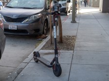
The proliferation of new modes of transportation — from e-scooters to Ubers — has presented city planners with a lot of new questions and not many answers. But a new initiative announced last week by San Francisco-based transportation analytics company Streetlight Data could soon lend a precise view of how these new technologies are changing communities.
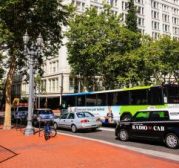
In particular, the initiative — called the Multimodal Measurement Initiative — is looking at how different types of travel interact and influence one another. Do ride hailing services like Uber and Lyft cut into bus ridership? Is your city’s new bike lane actually reducing vehicle traffic or do the numbers only make it look that way? Those were are the kinds of questions the company was hearing from its clients all the time, but didn’t have definite answers for, said Streetlight Data founder and CEO Laura Schewel.
But as the information gets clearer, the company want to find partners to build on recent momentum.
“It’s been very hard to do. The data science is tricky, but we feel like in the last couple months we’ve really broken through the data science barrier,” Schewel told StateScoop. “We have a product we deliver that we know we can continue to deliver, so we’re ready to go on measuring travel in different modes … and start to really understand how we can measure the way the modes interact.”
Wide open for collaboration
The initiative isn’t just the company announcing to the world that it’s open for business, but a call for partnership. The complexity of these transportation questions requires data and collaboration, and Streetlight Data is looking for both. The initiative’s website asks for “early-adopter clients” — government agencies, academic institutions, private transportation firms, or multimodal data providers with projects planned for this summer or early fall that require multimodal data — to join a summer working group.
Schewel said the company will probably start announcing its working group partners “in the next week or so.” This working group, she said, will be focused on bicycles, pedestrians and ride-hailing services, with other modes of transit like ferries, trams and subways expected to be added later this year, assuming early efforts progress smoothly.
For many new transportation technologies, data is scarce. Pedestrian and bike counters are rare, she said, a lot of Uber and Lyft vehicle pattern data is proprietary. And for the data that is available, validating its accuracy can be challenging, Schewel said.
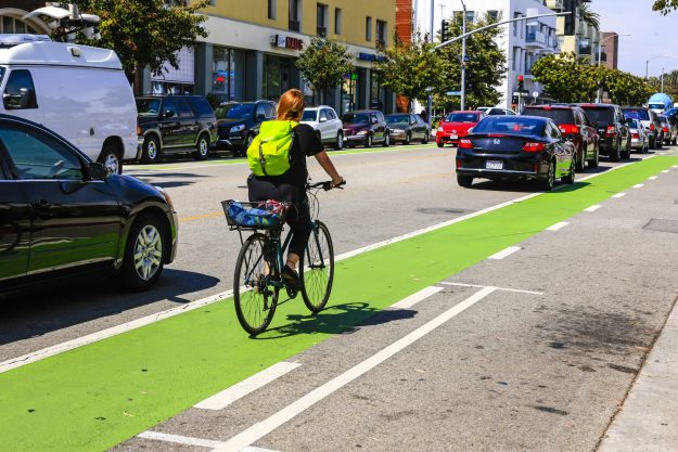
If a city installs a new bike lane, for example, it may also install a counter to see how much the lane is being used. But an uptick in bike usage along just one route does not provide the kind of comprehensive picture that transportation planners need to make decisions affecting an entire city.
“It’s true that biking at that point increased, but they don’t know if there’s actually more biking in the community happening or if the bikes just rerouted to take the routes of the bike lane,” Schewel said. “And what they really don’t know is if the biking displaced driving.”
Beyond LOS
The data is also expected to help California transportation agencies as they seek to meet new requirements expected to go into effect in 2020 in accordance with a 2013 law that tweaks which transportation data is analyzed by the California Environmental Quality Act.
The new changes call on California agencies to stop using an old form of environmental impact measurement, called “level of service” or LOS, which measures car traffic delay to gauge environmental impact. Essentially, LOS is a narrow, car-centric measurement that unintentionally encouraged developers to avoid vehicle delays at all costs, since that’s how they were being measured, which often came at the expense of alternative forms of transportation.
The result was urban sprawl — wider lanes, bigger intersections, and anything else to keep vehicle traffic moving — which left less room for niceties like sidewalks or bike share stations and other infrastructure that today are generally thought to make an urban area more hospitable.
In place of LOS, the law calls on agencies to use “vehicle miles traveled” or VMT, a measure of the amount of driving a new development is expected to generate. This broader metric is expected to level the playing field as it includes a more holistic accounting of various forms of transportation and it is also expected to provide a more accurate assessment of environmental impact given today’s diverse and widening array of transportation options.
Understanding how various modes of transportation interact could go a long way to informing these measurements and ultimately determine what the future of the country’s transportation infrastructure will look like.
Particularly as autonomous vehicles inch closer toward commercial markets, there is a growing desire by government policymakers to understand how the technology could benefit society or pose safety risks . For Schewel, this goes beyond environmental impact or maximizing roadway efficiency — she’s pushing for social responsibility.
“If autonomy starts hitting the streets and we’re not measuring the way it impacts equity and accessibility, we will not be able to manage the future trend,” she said. “This is important to do in its own rite, but it’s really practice to get ready for responsibly managing very new transportation technologies.”