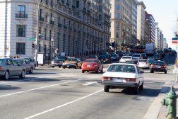
D.C. to share traffic data with Google for Waze app

The District of Columbia and Google have struck a data-sharing agreement that would give local users of Google’s Waze navigation mobile application enhanced information supplied by the District, StateScoop has learned.
The agreement represents the most recent move by Google to expand on Connected Citizens, an initiative, announced in October, aimed at giving real-time, anonymized crowdsourced traffic data to government agencies in exchange for public occupancy and construction traffic information. When the initiative launched, it had 10 partners globally.
Waze, which Google Inc. acquired in 2013, displays traffic alerts like slow traffic, potholes, police activity and disabled vehicles while a user navigates to a destination.
In the case of D.C., Google will receive information ported from the District Department of Transportation’s Online Permitting System, or TOPS, and DDOT’s internal project tracking database, ProTrack.
“The data we provide will display existing construction projects, emergency utility work and special events,” a D.C. public official told StateScoop on background because the deal had not officially been announced.
“This information comes from features services we provide in GIS [geographic information system] format. The icons will represent activities that temporarily affect public space and commute travel time. Each one will display various details when selected. That’s the goal.”
The department’s agreement with Google comes as it continues to roll out new features to TOPS. In the past few months, the department has introduced features to allow users to update information on Emergency No Parking Signs and apply for Sidewalk Cafe and Loading Zone permits.
According to José Colón, the chief information officer at DDOT, the department has introduced the ability for users to print Emergency No Parking Signs from any location, in order to allow them to modify the date and time printed on the signs.
“In an effort to reduce citizen frustration, confusion and erroneous enforcement, the utility companies and developers now have the ability to print ENP signs from their office or any of the remote kiosk locations [located across the city] with current data and time of actual occupancy,” Colón told StateScoop in an email. “They can print the signs as often as need for a project throughout the life of the permit.”
From there, the system will track any conflicts and notify inspectors when work is actually being performed, according to the data the user will input into TOPS. Now signs can be updated, reprinted and reposted when workers actually need to occupy the public space. Before the upgrade, ENP signs had a static start and end date, which Colon said could cause confusion for enforcement officers and residents, and a lack of efficiency when public space was occupied when work isn’t actually being performed.
Through the Sidewalk Café module, the TOP system can now collect information from applicants, including how many tables, chairs, umbrellas or fences could occupy a public sidewalk. The system will also be updated with information about the days and hours of operation and added to a public-facing map displaying the sidewalk café’s location and information.
With loading zone permits, TOPS can provide daily and annual loading zone parking permits right to the user. The program initiated better management of loading zones and will reduce double parking during loading times. According to Colón, the new permitting update will improve traffic flow throughout the District.
All of the data from these new upgrades, and any future upgrades, to the TOP system will be ported to the Waze mobile application, according to the D.C. public official. The partnership between Google and the District will be announced in the coming weeks.