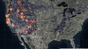
Unprecedented national database shows who has access to parks

A new database and analytics tool — called ParkServe — is providing a detailed look at who has access to public parks in more than 14,000 U.S. cities.
San Francisco-based nonprofit Trust For Public Land made the database public on Tuesday. ParkServe gives users detailed information on the current state of city parks and which Americans have a public park within a ten minute walk of their homes. The tool uses machine learning and geographic information systems (GIS) to determine where public parks are most needed.
ParkServe’s analytics are already being used by city planners in Atlanta, Houston, Fresno, California; and Boston, among other cities.
To create the database, ParkServe first compiled a list of about 14,000 municipal contacts and asked them for information, but only 12 percent responded, said Emmalee Dolfi, a project manager for ParkServe. As a result, much of the data used in project was manually created by the ParkServe team, often without local knowledge of the places they were sampling.
To remedy this, Dolfi and her team created an integrated tool called “Park Reviewer.” Using Park Reviewer, users can submit data and analytics for their own cities or suggest edits to the existing data. So far, ParkServe has received more than 1,000 responses via Park Reviewer, according to the nonprofit.
“We’re really hoping that people will interact with the project,” said Breece Robertson, a vice president with the Trust For Public Land. “Crowdsourcing is going to make the data that much better, and more useful.”
One of the other ways users can interact with ParkServe is by using the “Park Evaluator” tool. The tool allows users to draw virtual parks anywhere in their city, and ParkServe will give the user detailed analytics on how useful that park would be, and how many residents would be within a ten minute walk from it.
“An example of the Park Evaluator tool in action is during city planning,” said Dolfi. “When a planner is decided between three locations for a new park, they can now see which site would be best served with the new public space.”
The Evaluator tool also ranks area without parks in the ten minute range based on severity of park need, population density, low-income household density, and youth density.
As ParkServe expands, the creators are planning to add new ways for people to submit information to the database.
These include an app for consumer drone owners to submit aerial photos of parks for analysis through a partnership with Hangar, and a similar Esri-based app that allows people on the ground to submit park photos, information on park quality, and rate the amenities available at their local parks.
The nonprofit also reports it is “working closely” with the University of Washington and Resilient Solutions 21, a consulting firm based in Albuquerque, New Mexico, to estimate park usage nationwide.
Several minor changes and additions were made to this story on May, 4 2018.


