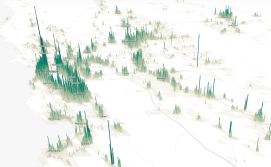
Map helps states spot hard-to-count districts for 2020 census

An interactive map in development at the City University of New York (CUNY) may be a useful tool for state and local governments hoping for fuller census counts in 2020.
The Census 2020 Hard to Count Map utilizes data from a variety of sources, including the US Census Bureau’s Planning Database and American Community Survey, to pinpoint the hardest to count (HTC) census tracts in the United States.
This map, which was launched early September, is certainly relevant to state and local programs looking for more adequate funding from the federal government, confirmed the map’s creator, Steven Romalewski, Director of the City University of New York Mapping Service.
“It’s available for anyone to use,” Romalewski told StateScoop. “Any organization that is involved in planning for the census and wants to help make sure the 2020 census is done accurately and fairly can use this map to support their work.”
StateScoop reported last week the consequences of an inaccurate census and how GIS technology could help remedy these results, but the people at CUNY find that there are more elements to consider.
The map indicates which areas of the US tend to be less cooperative in the self-response section of the census, which Romalewski says is a main factor in undercounts.
To compensate for undercounts, the Census Bureau sends enumerators door to door to gather information — a task that can be difficult and costly. If these HTC groups are not counted fairly and accurately, however, they may be at risk receiving unequal political representation and missing out on vital public and private resources.
According to Romalewski, a lack of internet access plays a significant role in HTC communities.
“In 2020, the main way the Census Bureau is hoping households will respond to the census is online,” said Romalewski. “So, people are concerned that, aside from all these other hard-to-count characteristics, there’s also the question of whether or not homes will even have internet access to begin with. And if they do, is it adequate for their completion of the online form?”
Another key feature of the map is its ability to search through multiple categories. The map’s users are able to identify HTC areas by searching for congressional districts, state and legislative districts, and individual addresses. However, the initial emphasis of the map is on legislative districts, said Romalewski, because Congress is currently in the process of determining a budget for the Census Bureau.
Varying search categories are particularly helpful to state and local efforts for a fair and accurate census, Romalewski said.
“It highlights the hard-to-count tracts of the census so groups can decide if they’re going to conduct outreach and where they should really focus their work,” he said.


