Improvements to GIS data generate more federal funding for states, study finds

The results of an upcoming study on the link between federal funding and the United States Census is exposing the need for better resourcing and positioning of geographic information systems (GIS) in state offices.
The study, Counting for Dollars 2020: The Role of the Decennial Census in the Geographic Distribution of Federal Funds, will not be completed until 2018, but its preliminary research and findings are recorded in a report highlighting 16 federal programs that use census-derived data sets to set state funding levels.
The report found that, in the 2015 fiscal year, all 50 states and the District of Columbia received a total of $589.7 billion from 16 census-guided programs — and for 15 of the 16 programs, the amount of funds each state received was guided by its 2010 census count.
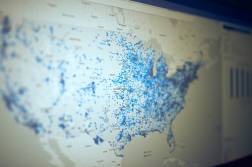
According to Bert Granberg, director of the Utah Automated Geographic Reference Center, the fuller a state’s count, the more the state will receive in federal funding. He says that accurate GIS data gives each state the best chance for the Census Bureau to achieve a complete count of its residents and thus potential for more funding.
The issue, however, is not the technology itself, Granberg told StateScoop.
“Advancements are made, but the core GIS technology is very mature,” he said. “However, the important supporting role that GIS plays is still underappreciated and, largely, needs better resourcing and positioning.”
Andrew Reamer, research professor at the George Washington University and author of the report, told StateScoop that this is exactly the type of response the study hoped for. “I think there is a connection between accuracy and fair distribution,” Reamer said. “The aim of this study is to make the public more aware.”
“The study demonstrates the value of helping [the Census Bureau] be as prepared as possible to do their enumeration and survey work,” Granberg said. “Partnering with [the Census Bureau] will also mean that states will receive back better quality map data for their 2022 redistricting efforts as well. Similar benefits are found in making the same data easily accessible to big search, delivery, and navigation companies.”
Keeping data current in near-real time is the best way, Granberg says, to ensure states’ residents are accurately represented and that the data is realizing its true potential.