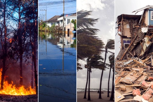
California wildfire crews gain edge with expanded data tools

Firefighters facing rapidly shifting California wildfires are getting added help to plan their attacks, thanks to a new stream of data resources from a state agency.
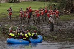
Firefighting crews can now get quick access to current and historic aerial photos, ground temperature and moisture readings, and other data to aid their decisionmaking through a new private cloud-based service set up by the California Natural Resources Agency.
“Fires aren’t static, so [crews] have to make decisions on the spot, [like] where are they going to cut the flames off and where are they going to try to redirect it,” said Tim Garza, director of IT at the California Natural Resources Agency, in a story reported by IT World.
Garza said data is important to helping firefighters and their supporting logistics teams respond effectively. But the data isn’t just for firefighters.
Other state agencies and citizens can also get current and historical data from the agency’s cloud, including information on water flows, soil erosion and climate change that are proving useful in efforts to manage water resources during droughts.
Prior to the new cloud system, data storage capacity was limited. As a result, Garza said, only current information was available and historical data was kept on tapes. People didn’t know where data was or if it existed, he said.
The new system reflects how a growing number of states, including California, are attempting to make statistics, maps and other information publicly available for citizens, programmers, and others to see and use.
It also reflects the outcome of a recent push by the California Natural Resources Agency to consolidate 30 data centers and server clusters into a single system that aggregates data from separate departments and state organizations to make it easier to find and use.
Crews responding to California wildfires can now access aerial photos, stats on ground moisture and wind, and other data to help them plan their attacks. “Fires aren’t static, so they have to make decisions on the spot, [like] where are they going to cut the flames off and where are they going to try to redirect it,” he said.