Crowdsourced photos help power flood-tracking app in Florida
The University of South Florida is expanding a flood-tracking app that proved useful after two major hurricanes, Helene and Milton, hit the Tampa Bay area last year. The app offers residents, emergency managers, and researchers real-time information about rising flood waters.
The CRIS-HAZARD app, short for Community Resilience Information System and created by USF professor Barnali Dixon and her team, combines photos from residents, feeds from strategically placed cameras around Pinellas County and artificial intelligence to let residents and emergency officials know when and where flooding is happening.
Dixon described it as “like Waze, but for floods,” because similar to the Google navigation app, which allows drivers to upload roadway information while in route to their destinations, the CRIS app is powered by crowdsourcing.
“We wanted to use this app to create a data set using people’s lived experience, so we can actually create data that can be used in the model using machine learning algorithms,” Dixon said.
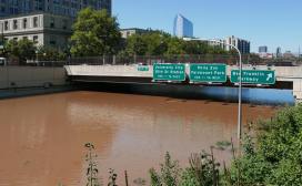
Over the past year, the project increased from eight cameras to 31, covering flood-prone areas in Clearwater, Belleair Beach and Tarpon Springs. Every 15 minutes, the cameras capture images that, along with photos submitted by residents, are analyzed by AI to estimate flood depth and severity.
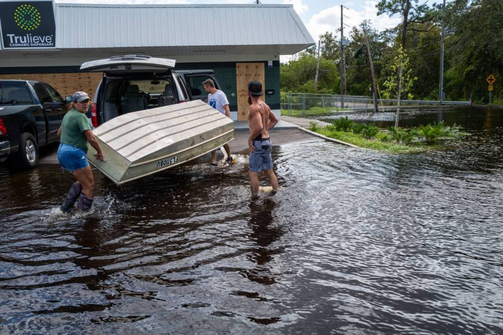
The app soft-launched in 2024, two weeks before Hurricane Helene would strike the coast. During the storm, Dixon said, residents tagged photos of rising waters, giving researchers data to validate their models and make predictions more accurate.
“We can train the model to extract flat height from those images,” Dixon said, adding that residents have the option to select whether the water is at ankle, knee, shin or hip height. “Because once we know the depth and extent of flooding from those photos and automate the process, then we can use that data and put it in the dashboard.”
Storm Squad
CRIS-HAZARD is also an important resource for the Storm Squad, a community-driven initiative that started in South St. Petersburg in 2021, that helps the Pinellas County officials address “hidden needs” in disaster response that traditional aid, like the Federal Emergency Management Agency, often overlooks.
Erica Hall, who chairs the Florida Food Policy Council and is a founding member of Storm Squad, said the flood-tracking app is part of the “backbone of Storm Squad’s mission,” allowing residents to upload real-time flood photos, updates on power outages and other information directly into a system used by emergency managers.
“This means trained community members can systematically report neighborhood-level conditions — like blocked storm drains, seniors needing medical ice during outages, or tenants without proper paperwork for FEMA aid — so that these ‘hidden needs’ are visible and actionable,” Hall wrote in an emailed statement. “The app turns local knowledge into data that can drive equitable response and recovery.”
Hall said county emergency managers use the app to identify where resources such as FEMA centers, tarps or food should be deployed. They also compare the resident data with official data sources to locate flooding, outages and displaced residents. She added that the app is a “two-way channel” that helps build trust between residents and their government.
“Residents know who to contact, and [the Office of Emergency Management] knows where needs exist in real time,” Hall said. “Nobody knows a neighborhood better than the people who live there. Storm Squad and CRIS give them the tools and the seat at the table.”
Hall said the plan is to expand Storm Squad, and CRIS-HAZARD, to other Florida counties and community collaboratives that face similar flood and hurricane risks.
Mary Burrell, community engagement program lead for Pinellas County Emergency Management, who also works with Storm Squad, said the app not only highlights flood-prone areas, but empowers neighbors to help each other and connect to emergency services.
“It’s neighbors helping neighbors, you know,” Burrell said. “So it’s kind of putting that in their hands with the app, but also with information and connecting them to emergency services.”