Government needs better air-quality messaging, not more data, says Portland official
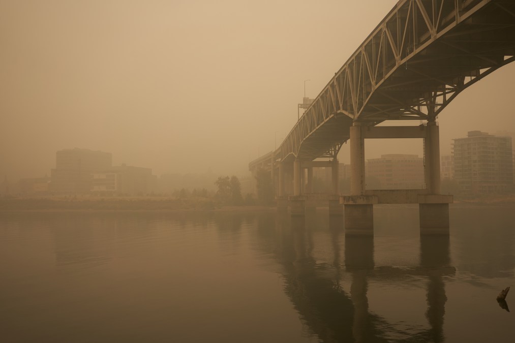
Raging wildfires have burned through more than five million acres along the Western United States this year, degrading air quality across Oregon, California and Washington for weeks on end. But state officials who have spent years deploying air quality sensors said that improving how that data is shared with residents — not necessarily collecting more data — is what’s needed most now.
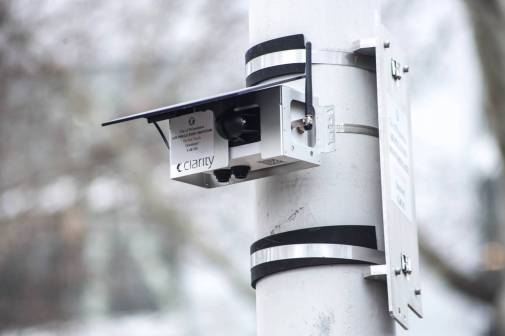
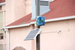
Portland, Oregon, is among the local governments rethinking its communication standards for sharing air quality data with residents. In an effort led by Christine Kendrick, Portland’s smart city coordinator, and Smart City PDX, a civic-tech program housed at the Portland Bureau of Planning and Sustainability, officials studied air quality sensor performance data and “internet of things” deployment over the past two years to improve the city’s ability to measure air quality.
But Kendrick, who holds a doctorate in environmental science, told StateScoop that despite all this work behind the scenes, many people still aren’t able to understand the raw data or understand air quality maps without expert guidance.
“The answer isn’t always more data or more sensors. We want to see action,” she said.
Public education
So far, Kendrick said, taking action has involved answering the most frequently asked questions of concerned Portlandians when determining whether or not it’s safe to go outside. This can boil down to details like why two different air quality measurements taken from the same location can vary or which government agency is responsible for publishing data.
Portland already works with the health department in Multnomah County, which contains Portland, and state regulatory agencies to gather information about air quality. she said. But in a survey sent to residents with help from Portland State University and Portland General Electric earlier this year, she said, community members said that though they preferred to see air quality data on a website compared to a mobile app or via email, figuring out which website to visit was a challenge.
“Really, we’re identifying what different audiences need to receive the air-pollution information they’re looking for,” Kendrick said. “So maybe somebody that’s used to looking at maps, charts and data needs a really different communication strategy than somebody that just needs to understand ‘when’s the best time for me to go to the grocery store for my family.’”
‘Where should I look?’
Ensuring all of the relevant data is available on one website is still a work in progress for Portland officials. Though these partnerships provide more data to agency officials across the different levels of government, Kendrick said, it can be difficult for residents to understand how the data on a county-level website compares to that of a city-level website.
“With the wildfires, what we were hearing was confusion around different sites: ‘Where should I look?’” Kendrick said. “What we’re going to work on in coordination with our partners and emergency management in the future to improve this is say, ‘Here’s what this resource will do for you.’”
During a regional event like a wildfire, she said, residents should be able to look at a single map aggregating data from various air-quality monitoring platforms and environmental agencies to see whether it’s safe to go outside, rather than visiting several different sites to compare data from different sensors around the state. The Smart City PDX team is also exploring ways to help people understand the difference between a commercial, home-use air quality sensor and technology that the state uses to gather data. Air quality sensors purchased and installed by residents can be very helpful in raising awareness and education about air quality, Kendrick said, but depending on how sensors are placed the data’s accuracy can vary substantially.
“Sometimes sensors can appear to be 1-2 magnitudes higher compared to calibrated instruments because there are standardized protocols for [government] instruments,” she said. “They can also be really impacted by how air is pulled into the sensor, and degradation can happen over time.”
The technology is improving for commercial sensors, she said, but for wildfires, the state’s monitoring stations gather enough data to provide an accurate sense of whether the air is clear or not within a reasonable time. Moving forward, however, she said the city hopes also to integrate local air quality sensor data into its communications.