California’s Department of Transportation, Waze team up to share traffic data
SACRAMENTO, Calif. — California’s Department of Transportation has teamed up with Waze’s Connected Citizens Program to share data and update drivers on driving conditions in real time.
As part of the agreement announced last week, Caltrans will pull anonymized traffic and accident data from Waze users into its QuickMap, an app that displays road conditions and closures on a Google Map. In turn, Waze will integrate Caltrans data into its platform.
Waze, which calls itself the largest community-based traffic and navigation app, gathers information about road conditions as it directs its users to their destination. Users can also contribute road information, like police traps and other hazards. Waze has more than 3 million traffic updates added by users in California’s major cities every month.
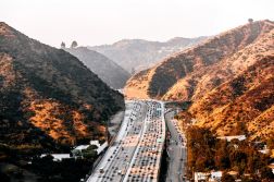
California infamous for its traffic. Last month, data company Inrix released a report that rated Los Angeles as the most congested city in the U.S., with its drivers spending an average of 81 hours in commute last year. San Francisco came in third on the list.
“Combining the real-time anonymous data from Waze, sourced from drivers themselves, with Caltrans’ vast network of traffic management systems is a win-win for California drivers,” Caltrans Director Malcolm Dougherty wrote in a press release.


