Washington’s Department of Natural Resources is showing what drones can do for government

As the federal government figures out how to regulate drones, state government is figuring out how to use them to make its work safer and faster.
The Washington Department of Natural Resources (WA DNR) started its drone — or unmanned aerial system (UAS) — program in 2015, but workers told StateScoop it wasn’t until this year that the program began to take shape. With a wide variety of applications in mind, from wetland mapping to emergency radio communications, the department is pursuing new projects across its divisions, and even applying for permission from the Federal Aviation Administration (FAA) to expand its projects into more experimental territory.
WA DNR applied to the FAA’s UAS Integration Pilot Program, which the agency calls an opportunity for state and local government to “accelerate safe UAS integration” and fly more advanced UAS operations, such as beyond visual line-of-sight or over people. The federal program, which closed “notice of intent” applications on Nov. 28, will select an undisclosed number of applicants after a multi-stage application process that ends on Jan. 4.
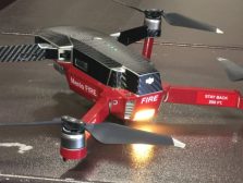
Miles Micheletti, who works within WA DNR’s forest resources division, told StateScoop his department has a lot of ideas in mind for future applications, like using drones to carry heavy seed bundles up dangerous slopes in forested areas, providing a radio tower link for firefighters working in rough terrain, monitoring the administration of herbicides and mapping landslides.
Improving worker safety is one of the key drivers of the technology’s adoption in WA DNR, Micheletti said, and as the agency has experimented in recent months with new applications, other state entities have begun to take interest.
Julie Jackson, a Washington state GIS mapping, training and support supervisor told StateScoop that while her department doesn’t use drones for much besides recording video footage inside tunnels, she hopes it will begin using them more. She even admitted to being a little envious of some of WA DNR’s drone projects.
Having word of mouth around the agency has helped drive the program forward, Micheletti said.
“That has really snowballed,” Micheletti said. “A lot more people know that our services are available that we can potentially help out with things they already do. And that’s really helped us a lot.”
While gaining FAA approval for new experimental projects would be a boon for WA DNR, the department is establishing a growing foundation that will likely allow the technology to move forward in the state regardless.
State agencies like WA DNR often use LIDAR data to map areas they’re working in, but Micheletti said that data isn’t collected very often, which would usually require someone to survey a site on-foot.
“With a small UAS, we can collect data that looks and performs very much like LiDAR data on a small scale,” he said. “In practice, that means we’re taking the drones out to the forest and flying them [autonomously] back and forth over an area — anywhere from a couple acres to several hundred — and taking photos every few feet.”
Each point on the image below represents one photo taken by a drone for such a project.
Micheletti said producing an image like this can take 45 minutes to an entire day, depending on the size and complexity of an area. Then the photos are loaded into modeling software made by AgiSoft called PhotoScan, where the images are combined and rendering into a 3-D model of points the department calls a “point cloud.”
Then, the point cloud is segmented into individual trees and the department estimates how many trees are in a site, they derive metrics about height and canopy, and then the data is reformatted into a report that can be sent back to their foresters.
“It ends up taking significantly less time, and costing much less, than asking the forester to hike through the unit and estimate those same metrics,” Micheletti said. “We’re also beginning to actually equip the foresters themselves with drones. That way, they can collect their own data and send it back to our team for processing.”
When it comes to drones, WA DNR may be in something of a unique position because it manages millions of acres of State Trust Lands, which means they only need to acquire special permission for drone use in outlying cases.
The department is finally starting to get a handle on which tools to use and how to make the technology work, Micheletti said, but it took a couple years to get there. Until this year, WA DNR was in the “pretty pictures stage,” he said, where employees would go out and take pictures and then not be so sure what to do with them.
Now, he said, they’ve transitioned into thinking in terms not of pictures, but data and products. And while Micheletti expressed some concern that public outcry over drones could inhibit or even possibly stop the program, he also said he’s also hopeful that the state’s focus on safety will bring people around to seeing how useful for government this technology could be.