How Lake Tahoe is fixing its evacuation route bottleneck
As one of the nation’s most popular tourist destinations and a region prone both to earthquakes and increasingly destructive wildfires, Lake Tahoe is in dire need of upgrades to its outdated public-safety systems. But transportation and public-safety officials managing those upgrades in the mountainous, bi-state region are confronted by unique funding, mobility and geographical challenges as they race against an unknown time horizon before the next natural disaster.
Those officials — spanning seven counties, two states and the federal government — met for the first time as a coordinated stakeholder group on July 2 to launch a technical assessment of the Tahoe region, led by the U.S. Department of Homeland Security’s Cybersecurity and Infrastructure Security Agency, that will clear the way for the development of a plan to upgrade its emergency services not just with next-generation 911 technologies, but with the implementation of public-warning systems, internet-connected devices and expanded mass transit systems capable of evacuating people more quickly.
The mission to upgrade warning and 911 systems within Lake Tahoe Basin began in earnest in October 2017 after destructive wildfires in California revealed a need for improved emergency communications in the affected communities. The problem in Tahoe is two-fold: It doesn’t have a consolidated, modernized 911 dispatch center or sufficient emergency warning technology that can handle the needs of four counties split between two states. And, secondly, even if it did, there isn’t enough transportation capacity to evacuate the population of visitors and residents in a timely fashion.
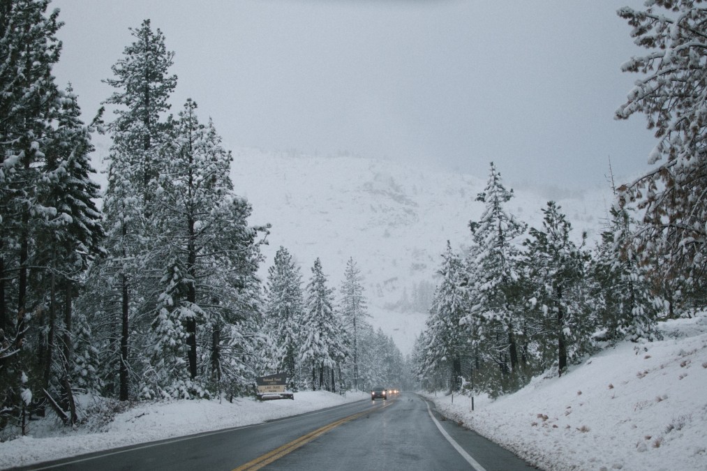
While Lake Tahoe has mostly avoided major wildfires, Jeff Meston, a former fire chief in South Lake Tahoe, California, wrote last year that such blazes are a “matter of when that will happen, not if.” And a USA Today study comparing the population-to-evacuation-route ratios of California communities found South Lake Tahoe to be in the bottom 1 percentile in California.
A unique 1987 compact between California and Nevada, signed in 1987 and managed by the Tahoe Regional Planning Agency, limits roadway expansion within the Tahoe region to preserve environmental protections and mitigate suburban growth. The agency’s 2018 report on transportation acknowledges that “roadways cannot simply be expanded to meet peak automobile travel demands,” which exceed 10 million vehicles annually.
The solution, according to Danielle Hughes, a program manager at the Tahoe Transportation District that manages transit throughout the Tahoe Basin, is anything but cars.
Innovation in evacuation
Hughes told StateScoop that the combined California and Nevada sides of Lake Tahoe receive an estimated 24 million visitors each year, virtually all of whom enter and exit the region through just six major roads.
Both the regional planning agency and the Tahoe Transportation District have signed on to a 10‐year plan that sets out to reduce dependence on cars in the region by 5 percent by 2028. The plan is to increase use of buses, bikes and trails.
But right now, Hughes said the state is looking to other modes of evacuation, such as how New York City ferried residents endangered by 9/11 terrorist attacks to safety along the Hudson River. For that to be successful, though, tourists and Tahoe residents would have to be aware that such an option exists.
“We aren’t building new roads, we’re actually looking at multi-modal solutions,” Hughes said. “To do that, you need to get that information out to the visitor, and that’s why we’re implementing these technology solutions.”
Hughes said she sees communications technology — like Wi-Fi kiosks, digital parking systems that show where open spots are, and fiberoptic conduit — as a backbone for regional transit and an important piece of communicating escape routes in the event of an emergency.
“I can’t get that information out to provide those solutions like implementing parking management systems and apps for knowing when to catch the bus or the ferry without putting in that communication network,” she said.
Though Tahoe is within a few hours of major cities like San Francisco and Reno, Nevada, Hughes said it’s not connected to the same communications systems or electronic grids, placing even more value on the security of the region’s infrastructure. Figuring out where to place underground fiber so that it’s not damaged by wildfires but still accessible for emergency and daily transit communications is one of a handful of tough logistical challenges being considered.
“Something like 80 percent of the communication networks failed in the Santa Rosa wildfires,” Hughes said, referring to 2017 wildfires that razed more than 36,000 acres. “And we’re trying to look at how to harden that, how to put up the backup infrastructure — because the end-warning system runs through the electrical grid, of course — so I’m now also trying to assess what kind of solar backup infrastructure I need with that.”
The end-warning system that the backup infrastructure will power is extensive. Devices such as cameras, weather and acoustic sensors, connected and artificially intelligent streetlights, digital message boards and kiosks are all part of Hughes’s plan to notify residents of sudden safety hazards.
Picking a plan
Right now, public safety officials have no way to gather real-time data on the movement of people and environmental factors in Tahoe. An ambulance or fire truck dispatched to an accident might have no idea that there’s a traffic backup or downed tree in the way.
The data collected by weather and acoustic sensors, as well as a connected camera system designed to spot wildfires called Tahoe Alert that went live in July, will be managed by software that first responders can use to predict incidents, Hughes said, and will help public safety officials better understand how visitors — and fires and avalanches — move around the region.
A mobile app designed specifically for visitors who won’t pay attention to county alerts usually delivered via text or email is also in the works, Hughes said. The app will include activities and other tourism-related info that officials hope will entice visitors to download it, but also practical tips like way-finding, transit schedules and construction delays. Each county’s warning system will also have direct access to the app to disseminate alerts and evacuation strategies. Software that manages the connected devices and mobile apps will take about a year to develop, Hughes said.
Any technical solutions, however, will need to be agreed upon by virtually all of the agencies operating in the region.
CISA will evaluate if agencies are proficient at sharing their resources, including devices, vehicles and personnel. It will also assess whether agency evacuation routes need to be clarified or whether alert notifications need to be expedited. CISA will also take the funding and technological limits of each agency into account, including how many dispatchers they have, how far their jurisdiction spreads and how many connected devices they can afford to analyze data from.
“It becomes really important to know what resources are available in the area now so you can use the closest available resource to meet the need that’s at hand. That’s what this is about,” said Budge Currier, a 911 branch manager with Cal OES. “That closest available resource could be somebody from Nevada, it could be somebody from that side of the Sierra down along the 395 corridor, and a system like this would allow you to identify that.”
CISA is expected to finish the assessment by October. Once concluded, the assessment will include three or four emergency strategies that the stakeholder group can choose between for implementation, Currier told StateScoop. Additionally, it will include possible locations for a consolidated 911 dispatch and traffic management center that would centralize elements of other dispatch centers around the region, such as those used for fire and rescue. By adding next-generation 911 capabilities like video and text-transmission to dispatchers, as well as more accurate location data, the new center would consolidate and expedite all public safety and resource-sharing efforts, Currier said.
Beginning in January 2020, California 911 centers will receive $175 million annually for upgrades, and Tahoe’s future regional dispatch and traffic management center won’t rely on that money, Currier said, but it could receive a portion once it’s completed.
Which connected infrastructure projects are adopted in the region will depend on which strategy the group chooses. For example, Currier said, the stakeholder group could decide to take a distributed approach to infrastructure management. Rather than letting one agency take the lead, it would let multiple dispatch centers analyze data from connected devices. The strategy chosen will be critical in evacuating the region and its inhabitants from the next wildfire or earthquake.
“That’s really, when you think emergency management and disaster planning, this would give you the best situational awareness to make the decisions needed to support the immediacy of the disaster at hand,” Currier said.