Counting cars was once a job in Raleigh — now an AI does it
Raleigh, North Carolina, has turned to machine learning to improve mobility and urban planning in the face of a “deluge of data” that the fast-growing capital city has acquired over the last several years, according to city GIS and emerging technology manager James Alberque.
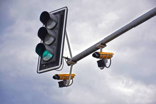
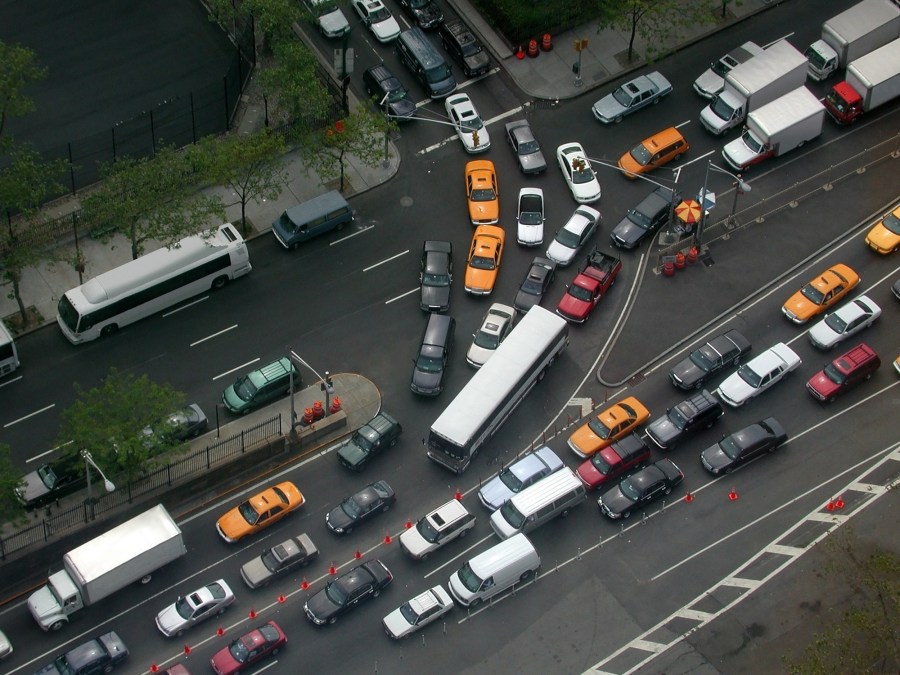
Speaking at an virtual conference hosted this week by the mapping technology company Esri, Alberque said the city of 460,000 has gone from contracting people to sit at intersections and count cars to counting traffic with machine-learning software in real time, supplying policymakers with more accurate data to manage the city’s traffic. The new capability, driven by technology from Esri and the video graphics company Nvidia, spurred the city to deploy an additional 500 traffic cameras on signal poles this year, as well as outfit garbage trucks with cameras to record traffic as they move throughout the city.
Raleigh grew by more than 50,000 people between 2010 and 2016, Alberque said, growth that provided the city an opportunity to process an unprecedented number of data points.
“Whether it be a scooter or a streetlight or a building or a vehicle, more and more everyday, those assets are being instrumented and reporting data to the city,” Alberque said.
Before the Raleigh began using software to record traffic and turn it into data, it relied on either in-person contractors to count cars, or GoPro cameras attached to signal poles. The agency then sent the data to third-party services to analyze off-site how many cars had passed through the city’s intersections in a given time frame, a process Alberque said was expensive and inconvenient.
To prove the process could be improved with AI, Alberque’s team outfitted a Raspberry Pi chip with a camera to record raw footage of traffic at an intersection and ran the video through TensorFlow, Google’s open-source machine-learning platform, which the counted cars.
“We have hundreds of cameras around the city that have traditionally been used to visually support traffic management, congestion management, event management,” Alberque said.
The program worked, he said, but it was only a proof of concept that had city employees “geeking out” over the technology. For Raleigh to begin outfitting its existing traffic cameras with machine-learning technology, he said, it needed a solution that could be scaled up to meet the needs of a large enterprise.
Alberque and Peter Sherman, a city engineer who specializes in geographic information systems, began working with Esri and Nvidia to use DeepStream, a software development kit developed by Nvidia designed for the creation of AI-powered video analytics tools. The city also built a dashboard to visualize where traffic is growing or ebbing. And not having to pay contractors to analyze the footage has proven to be a “huge cost savings” to the city, Alberque said.
The use of AI is a growing trend in city governments seeking to improve roadway safety and reduce congestion, including Washington, D.C., which awarded a transportation research team $25,000 in February 2019 to test how CCTV cameras could help collect traffic data. In 2018, Detroit debuted a series of AI-powered tools in five intersections across its downtown region to measure how pedestrians and riders used sidewalks, traffic signals and road signage.
This story was featured in StateScoop Special Report: Digital Government: The Next Decade (2020)