New Orleans’ new ‘smart port’ to size up supply chains, flood risk
A joint initiative between the Port of New Orleans and a nonprofit research institution will test whether using data-collecting sensors can help officials make better business and operations decisions both in and out of the water.
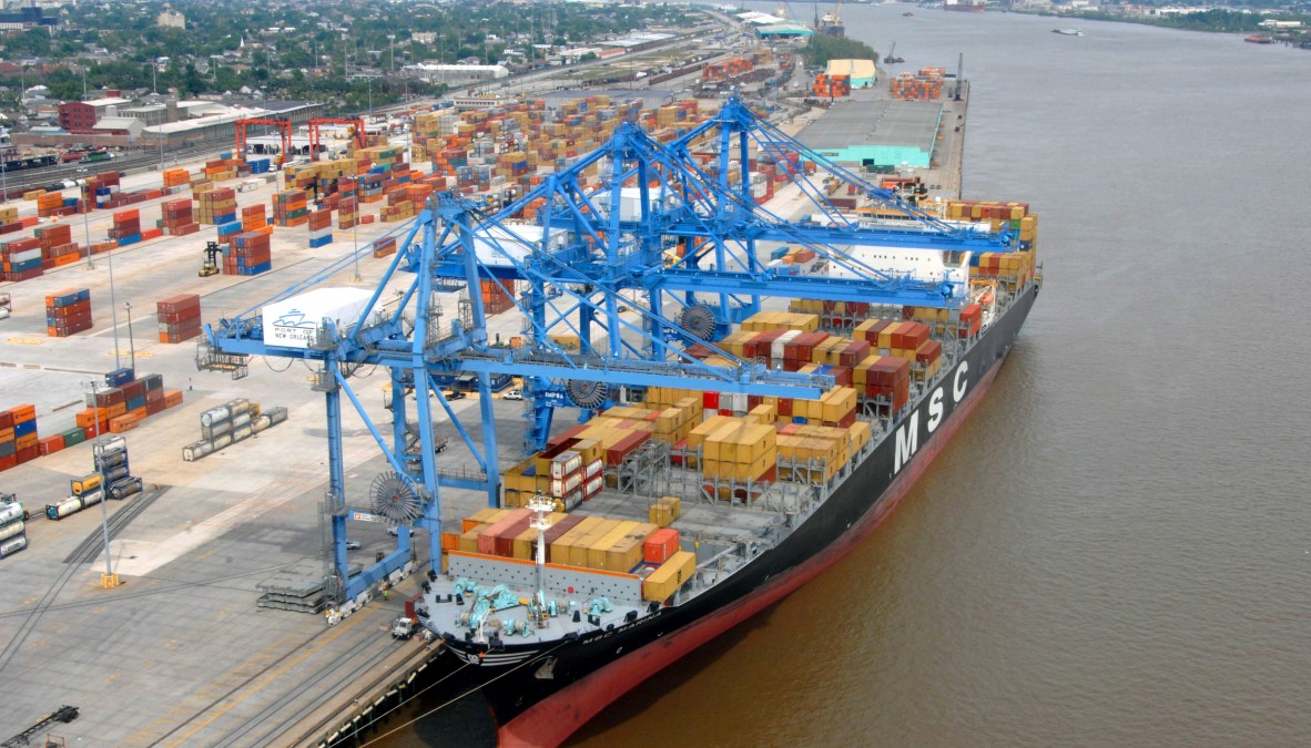
Louisiana Gov. John Bel Edwards announced Monday that the New Orleans port will begin a three-phase “smart port” project to test how traditional “smart city” technologies, like connected sensors that collect and analyze environmental and traffic data, might be used in a port setting. Cities have in recent years installed sensors to collect data on publicly owned buildings, roads and intersections, but less frequently in commercial spaces like ports or airports, which have more commonly used other emerging technologies like facial recognition to boost security. Edwards said that the smart port project would also protect against threats, and streamline the shipping process, from ship to warehouse.
In a press announcement, Edwards said the project will serve as “a model for the future of maritime commerce in Louisiana.”
The first phase of the project will call on the Water Institute of the Gulf, a nonprofit research organization dedicated to better understanding the Gulf of Mexico’s ecosystems, to install sensors on tugboats and other ships that frequent the New Orleans port. The sensors will collect data on the sediment levels in shallow areas of the Mississippi River, allowing engineers to make smarter decisions about when to excavate underwater rubble or waste. The $125,000 project will be financed by the Port of New Orleans and will take two months, according to the announcement.
The project’s second phase will assemble the supply chains of container depots, road transporters, dock terminals, shipping lines, warehouses and cargo operators on one digital platform, creating a “unified digital command.” The consolidated supply chain model, which is expected to reduce shipping times and improve safety, could eventually be used in other ports across the state. The coronavirus pandemic has already established the benefits of digitally connected supply chains over the last several months as public health organizations sought ways to ensure essential workers had access to personal protective equipment.
A third phase would see Louisiana build a “Hurricane and Flood Risk Center” to support the Governor’s Office of Homeland Security & Emergency Management, the Louisiana National Guard and other emergency organizations. The center would collect and model environmental data to predict and prepare for flooding events, using the “smart port” as a foundation.
Flood data has been integral to the emergency preparations of states for years, both before and and during events likes hurricanes. In 2017, technologists in Texas used geographic data to help the government understand the needs of victims of Hurricane Harvey. Iowa state officials said in June 2019 that they were able to respond to flooding quicker than ever thanks to an environmental health data portal they’d completed the year before.