
Gridded census data is coming, says bureau geographer
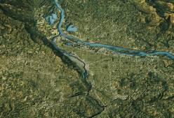
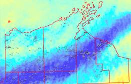
A U.S. Census Bureau geographer said the agency will begin releasing gridded data — “geographic units of a regular pattern, repeated shapes, without gaps or overlaps.”
A U.S. Census Bureau geographer said the agency will begin releasing gridded data — “geographic units of a regular pattern, repeated shapes, without gaps or overlaps.”

Many more states are expected to incorporate GIS into their voter registration systems by 2027, according to a new NSGIC report.

On the Priorities Podcast, Kansas IT chief DeAngela Burns-Wallace talks about how cyber fits into her top priorities, and NSGIC’s Jenna Leveille and Dan Ross on the group’s future.
The National States Geographic Information Council named John Jordan, of the Pennsylvania Academy of Family Physicians, as executive director.
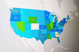
The National States Geographic Information Council’s biennial report shows states are advancing on GIS efforts, but are still far from perfect.

Dan Ross, who’s leaving state government in January, will temporarily serve as NSGIC’s executive director.

The federal government’s National 911 Program and Mission Critical Partners are assessing which jurisdictions need help with their geospatial data technology.

NSGIC Executive Director Molly Schar said that after five-and-a-half years in her role, she’s stepping down to try something new.
Smith, who helped get the federal Geospatial Data Act passed, will serve in a newly created role at the National States Geographic Information Council.
Perhaps more than technology, the expertise of locals can propel a geographic information systems project, said Wisconsin GIO Jim Giglierano.