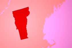
Vermont implements new railway-monitoring system
The Vermont Agency of Transportation (VTrans) Rail Section recently implemented ArcGIS Online to manage state-owned rail assets and improve emergency response. In addition, the agency uses the Esri Collector for ArcGIS and Operations Dashboard for ArcGIS apps for field data collection and oversight of Vermont’s rail network.
To eliminate data silos, VTrans replaced its spreadsheet-based asset management system with a secure, cloud-based GIS for managing its network. The agency uses ArcGIS Online to display all its rail property and asset information in various map viewers accessible by VTrans personnel and the public.
To improve its rail inspection and emergency response, VTrans uses Collector for ArcGIS. Recently, Collector enabled field staff to gather condition information on 379 public rail crossings in just six weeks, nearly three times faster than last year. This valuable information will help VTrans plan maintenance and upgrades for years to come. VTrans field staff also used Collector to share damage reports during Hurricane Sandy, including photos for faster evaluation of storm damage.
VTrans uses Operations Dashboard for ArcGIS in its rail asset inspection process to perform high-level analyses of crossing conditions. Operations Dashboard also provides up-to-the-minute situational awareness by displaying real-time weather information, asset condition reports, and photos for emergency responders and state officials.
To view the public version of the VTrans rail mapping system, visit rail.vermont.gov.