The Geospatial Data Act might get an amendment

Congress next week will take up an amendment to a landmark 2018 law that minted long-awaited rules for the collection and use of geospatial data, a source familiar with the legislation told StateScoop.
Cy Smith, policy director of National States Geographic Information Council, a GIS advocacy group, told StateScoop that Sen. John Barrasso, R-Wyo., plans as early as next Monday to file an amendment to the Geospatial Data Act, calling for three new studies on mapping technology. (He said Rep. Bruce Westerman, R-Ark., may work on a companion bill in the House, but Westerman’s office told StateScoop it hasn’t committed to such a bill.)
Smith said the studies — which would focus on “community engagement,” national spending and geospatial data’s impact on the economy — would close gaps in the original legislation and push the nation closer to a shared infrastructure for the collection and use of geospatial data.
“The governance structure was something that needed to be addressed in the original Geospatial Data Act and we knew that, but there wasn’t any way to do it,” Smith said in an interview. “You have to get the whole community engaged and socialize it and get agreement on how you’re going to move forward.”
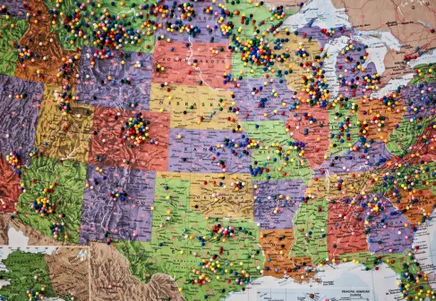
The Geospatial Data Act was celebrated by practitioners of geographic information systems after decades of stymied work to create a set of standards and policies that would reduce duplicative efforts and enable data-sharing across all levels of government and the private and nonprofit sectors. The 2018 law didn’t, however, include a funding mechanism or a concrete governance structure for accomplishing those aims.
Smith said the Barrasso amendment, expected to be the first of at least two amendments to the act, will chart a path to a more-complete realization of a National Spatial Data Infrastructure, or NSDI, the GIS community’s white whale. Smith said a community-engagement study mandated by the amendment would help establish the roles that each type of organization and government agency would play in such a national infrastructure.
“We want to get the community engaged so that the whole community can figure out and agree on how the governance would be structured for the NSDI to actually work so we can actually be creating all the data we need to share and maintaining it in the right way over time with all the right players engaged,” said Smith, who also serves on the National Geospatial Advisory Committee, a U.S. Interior advisory group created by the Geospatial Data Act.
A second study, he said, would examine how much money federal agencies are spending on geospatial data annually. Smith guessed the figure is around $500 billion, and said state and local governments are probably spending another $500 billion. A lack of coordination has led much of that work to be duplicative, he said. (One example is the address data collected by the Census Bureau, which it is not legally permitted to share. A parallel effort by the U.S. Transportation Department and state leaders has meanwhile cropped up to create an open national address database.)
The third study would examine the GIS market and how it affects the broader U.S. economy.
“I think both of those two [latter] studies are going to point out to Congress that this is a pretty big deal and we’re not managing it very well,” Smith said. “That will hopefully get us to the point where we can pretty easily get this governance structure in place and we can start to get a better investment by Congress.”