California emergency agency uses high-tech fire plane for storm response

Amid a series of storms across California that have so far led to the deaths of at least six residents, the state’s emergency services agency is repurposing some of its firefighting technology to optimize how it allocates personnel and equipment.
The storms, which began around the New Year’s holiday and are expected to persist throughout California for at least another week, are flooding communities, downing trees and utility poles and damaging a growing number of homes and businesses.
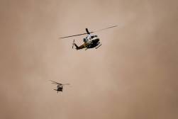
An official from the California Governor’s Office of Emergency Services told StateScoop that an essential piece of technology in responding to the extreme weather has been the Fire Integrated Real-time Intelligence System, or FIRIS, an airplane equipped with infrared cameras and data-forecasting tools.
Cal OES has been using FIRIS for the past several years to map hazardous areas during the state’s increasingly devastating wildfire seasons. The agency took full control of the system last year, taking possession of an aircraft previously owned by the Orange County Fire Authority. FIRIS also receives data-modeling support from a supercomputing center at the University of California, San Diego.
Diana Crofts-Pelayo, Cal OES’s assistant director of crisis communications and public affairs, told StateScoop the plane has more recently been used for emergencies not caused by fires, including oil spills, train derailments and severe weather.
“We typically use this airplane to forecast and predict the size and breadth and scope of a wildfire during wildfire seasons,” Crofts-Pelayo said. “But we were actually using it to fly over areas that were getting inundated with rain and flooding.”
Crofts-Pelayo said the imagery collected by the plane — which is transmitted to the state’s Wildfire Threat and Intelligence Integration Center — has been helpful during the storms to distribute resources and station emergency personnel to help communities.
“In a fire or wet weather event, what we do is we have, ready to go, crews from local governments throughout the state that are willing and can lend a hand to other local governments when needed,” she said. “We’ve asked for those crews to be pre-positioned ahead of any inclement weather in areas that we saw because of the future forecasting that would be prone to major flooding or snow or damage to local infrastructure.”
California Gov. Gavin Newsom on Wednesday declared a state of emergency that opened up additional emergency funding and activated the state’s Flood Operations Center, which helps with forecasting. Crofts-Pelayo said the state has made “significant” moves of its emergency personnel and resources as a result of the imagery and weather forecasts generated by FIRIS. On Wednesday, for example, the agency asked the fire department from the Central Valley city of Bakersfield to head north to support El Dorado County, outside Sacramento, in case its “swift water” team was needed.
Crofts-Pelayo said her agency is also working with the state Department of Water Resources to help distribute thousands of tons of rock, rubble and sandbags to local governments.
“We’re trying to use different layers of data to help predict some of this,” she said. “Some of it too is we just know from previous years and decades that burn scars are going to very likely be hit by mudslides and flooding and so we intentionally put resources and personnel out there so that they could help at a moment’s notice.”
Improved intelligence has been critical to protecting life and property during the harsh weather, Crofts-Pelayo said. The response effort has also included distributing generators and cots to shelters and warming centers.
“We are coordinating super closely to ensure that local and tribal governments have what they need to keep their communities safe and to protect their property,” she said. “You really can’t make all these decision points in a vacuum, so you really take for consideration as much data as possible on top of previous lessons learned in the decades of experience we have here.”


