As wildfire satellites enter orbit, early adopter states prepare for new data
As much of the western United States enters peak wildfire season, the nonprofit Earth Fire Alliance is providing more space-based technology to emergency managers with the launch this month of its first three operational FireSat satellites.
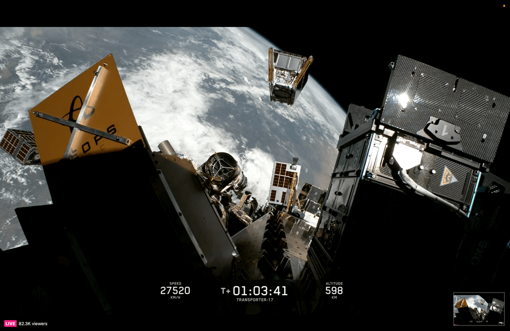
The satellites, which launched July 7 from Vandenberg Space Force Base in Southern California, aboard SpaceX’s Transporter-17 ride-share mission, marks a milestone in a global effort to detect wildfires within minutes of ignition and give first responders earlier warning before small fires become major disasters.
According to the alliance, the three satellites will spend roughly three months undergoing testing before entering service. Once operational, they will provide at least twice-daily observations across fire-prone regions worldwide. The nonprofit plans to continue expanding the constellation of satellites, with a long-term goal of achieving hourly global wildfire coverage by 2029.
The launch builds on FireSat’s protoflight satellite, which entered orbit last March and demonstrated the ability to identify low-intensity fires that other space-based systems often miss. That satellite is designed to detect fires as small as five-by-five meters, giving emergency responders earlier situational awareness during the critical first stages of an ignition.
“The big initiative for us and for other agencies is wildfire modeling,” David Shoemate, a geospatial systems coordinator with the Texas A&M Forest Service, said in an interview.
As one of FireSat’s early adopters, Shoemate said, the Texas A&M Forest Service, which leads wildfire and forest management across the state, plans to use the satellite constellation’s high-resolution wildfire data to improve predictive modeling, enhance situational awareness and better understand wildfire behavior across the state’s diverse landscapes.
“[The benefit is] being able to see what FireSat saw, what did they record, and then feeding that back into a model or comparing that to model outputs to understand how close are we to kind of mimicking this landscape and the conditions that were present at the time of this fire,” Shoemate said.
Shoemate said his agency hopes the data will help predict how future fires will behave, allowing responders to determine “where’s this fire going to go, how much time do we have,” and whether an incident will require a significant deployment of resources or burn itself out quickly.
Filling the gap
FireSat’s multispectral infrared sensors are paired with artificial intelligence models that compare incoming imagery with historical observations to distinguish emerging fires from false alarms, filling a longstanding gap in wildfire monitoring. Earth observation satellites often pass over the same location only a few times per day and are optimized for broader environmental monitoring, rather than detecting newly ignited fires.
For state and local emergency management agencies, faster wildfire detection could improve evacuation planning, resource deployment and incident coordination.
“Our ability to get data to make real-time decisions, to find fires when they’re small and help make better management and leadership decisions when we do have incidents on the ground is one of the biggest advantages of the program,” Travis Medema, chief deputy of the Oregon State Fire Marshal, said in an interview.
As another of FireSat’s early adopters, Medema said, his agency plans to use the data to improve incident response and evaluate how new geospatial information can strengthen wildfire operations across the state.
Over the coming months, Medema said the department will work with Earth Fire Alliance to integrate FireSat into its geospatial information systems platforms and common operating picture, with support from the department’s Center for Analytics, Intelligence and Research. He said the goal is to ensure the data is seamlessly available to incident commanders.
“We’re hoping to really start to see that data and see how we’re going to apply it into our common operating pictures and our platforms, and how we can operationalize that data and what it means for efficiency and effectiveness,” Medema said.
Future uses of fire satellite data
While Oregon’s immediate focus is wildfire response, Medema said, the state also sees long-term potential for using FireSat imagery alongside other datasets to evaluate forest and fuels management efforts.
Earth Fire Alliance estimates that a fully deployed FireSat constellation, capable of hourly revisits, could reduce wildfire damage, protect thousands of homes annually and provide a new global dataset for firefighters, researchers and public agencies responding to increasingly severe fire seasons.
But for now, he said, the priority is understanding how the new satellite data can improve wildfire operations: “On wildfires, we may be able to look at fuels and if fuels treatments have been completed, and sync that up with other databases, but we’re really focused on getting the data right now and how we’re going to use it in the wildfire space.”
Beyond improving response, Shoemate said, Texas plans to use FireSat’s data to strengthen its long-term wildfire records and better understand fire activity across the state. He noted that FireSat could also help detect fires that traditionally go undocumented, providing a more complete picture of annual acres burned and wildfire activity.
“Wildfire occurrence information is always very valuable to us,” Shoemate said. “We’re going to learn as we start to get some of the data [and] see how well it can detect some of the smaller fires, so that we can incorporate that data into our historical information.”
Shoemate said he expects FireSat to become a collaborative tool, both in Texas and with wildfire agencies worldwide. He noted that the constellation’s global coverage could help agencies compare wildfire behavior across regions facing similar threats: “I think one of the most interesting aspects of FireSat will be the global data collection. Having this common collection is going to be very helpful to everyone to be able to study and learn together.”
Medema echoed that sentiment, adding that Oregon, like the other early adopter states, including California and Colorado, could be a test case for operationalizing satellite technology: “We’re really excited to be part of that cohort, and get that integrated FireSat data and figure out how we’re going to use that, how do we better integrate it into our business model.”