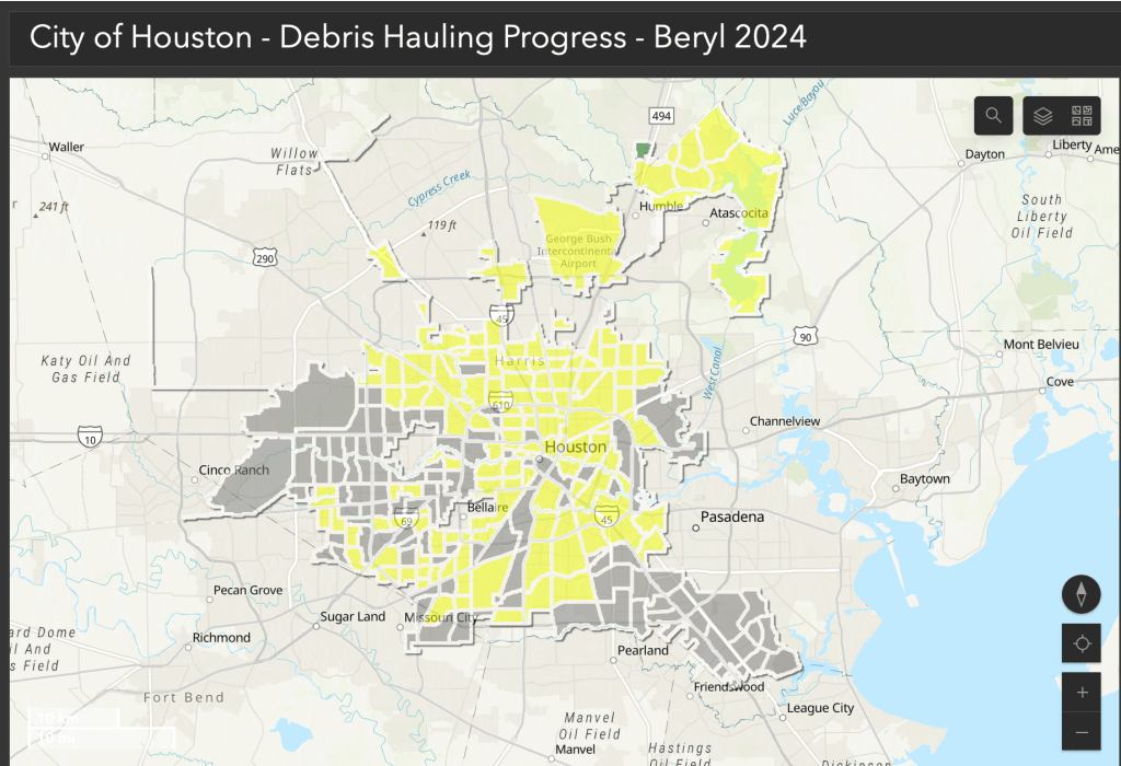
After Hurricane Beryl, Houston tracks debris collection with public map

After Hurricane Beryl wreaked havoc in Houston earlier this month, the city’s Department of Solid Waste Management has released an interactive storm debris collection tracker that allows residents to see the progress of debris pickup.
The tracker shows the areas where waste management trucks are removing debris from curbsides and roadways. The color-coded map breaks down the hauling progress by collection zone, and users can search by address. The tracker is updated at 8 p.m. every day.
As of Tuesday, the map indicates that a first pass of debris pickup is still ongoing in most areas. Upon completion of the first pass of storm debris collection, the waste management agency plans to begin a second pass.

Local reports on Monday said large piles of storm debris have remained on many residential streets since Hurricane Beryl ripped through the city on July 8, making landfall as a Category 1 hurricane, with winds of up to 95 mph. On May 16, the city sustained storm damage from a rare derecho storm that caused somewhere between $5 billion and $8 billion in damages and killed eight people.
In a statement, the Houston Department of Solid Waste Management said the combined impact of this year’s natural disasters in the Houston area is estimated to have produced more than 4.5 million cubic yards of storm debris. Before Hurricane Beryl, the department said, it had already removed more than 1.7 million cubic yards of debris created by the derecho storm in May.
Over the next couple months days, the city said it will expedite debris removal operations in neighborhoods throughout the city, using all its available resources along with contracted disaster collection companies.


