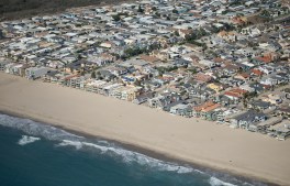
Oxnard, CA – October 05, 2026: Oxnard Shores photographed from an airplane on Monday, Oct. 5, 2026 in Oxnard, CA. Topographic LiDAR survey of the California coastline funded by the state of California monitors coastal erosion and morphology due to increasingly large storm and weather events along with rising sea levels. This survey serves as a baseline for future surveys and was conducted just before and after an active El Nino winter season.(Kayla Bartkowski / Los Angeles Times via Getty Images)
The National Oceanic and Atmospheric Administration has forecasted a 75% chance that this year’s El Niño will become a historic event, increasing the risk of high tide…
New reports from the nonprofit Markle Foundation's AI for Disasters and Emergencies Initiative found that AI holds great benefit for emergency management agencies, if they can clear…
Newly launched satellites can detect relatively small blazes, giving emergency responders earlier situational awareness during the critical first stages of an ignition.
A makeshift memorial dedicated to the lives of the 25 girls and two teenage counselors who were killed during last year’s Texas Hill Country flash floods is seen on June 24, 2026 in Hunt, Texas. Camp Mystic has filed for Chapter 11 bankruptcy nearly one year after the devastating July 4th Texas Hill Country floods that claimed the lives of 25 girls and two teenage counselors at the camp’s location along the Guadalupe River. (Brandon Bell / Getty Images)
A year after catastrophic flooding in Texas's Hill Country exposed critical gaps in emergency warning systems, state and local officials are expanding efforts in flood detection technology.
Rather than developing new AI models, the AIDE initiative focuses on developing practical ways the technology can support state and local emergency managers before, during and after…
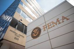
A recent review of FEMA offers hints at some of the challenges local governments may face in preparing for future disasters and large-scale emergencies.
A new flood monitoring platform in Philadelphia aims to provide real-time information to residents of some of the city's most flood-prone neighborhoods.
Officials and public safety firms told Congress that FirstNet could use some improvements, including stronger oversight or the introduction of additional service providers.