International fire satellites aim to boost wildland research and firefighting
With wildfires becoming more frequent and devastating due to climate change, emergency responders, government agencies and researchers are often forced to be reactive, rather than proactive, when it comes to containing blazes and saving lives.
To better equip emergency responders and researchers with more robust and frequent data of wildland fires — unplanned, uncontrolled fires that occur in natural areas like forests, grasslands or brushlands — a nonprofit recently launched a new satellite system designed to help emergency management teams better detect, track and respond in real time.
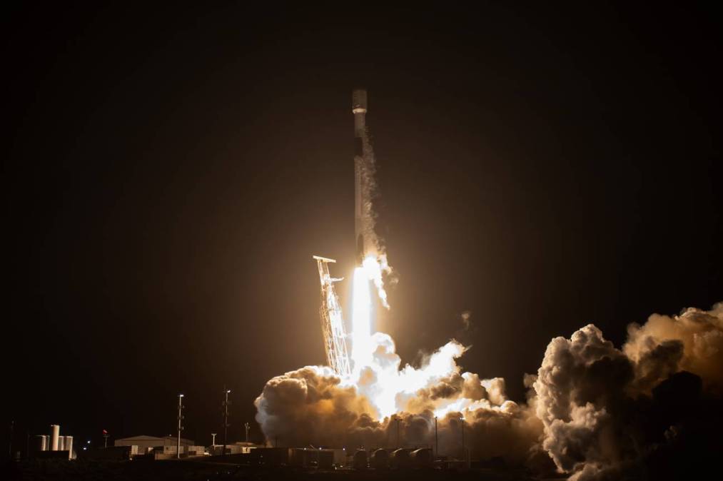
On March 14, the Earth Fire Alliance, a California nonprofit, and Muon Space, a company that builds low-orbit satellites, successfully launched the first flight of the FireSat satellite constellation.
By capturing high-resolution images of the Earth every 20 minutes, the satellite aims to solve the three main challenges of global wildfire mitigation: early fire detection, real-time tracking of fire movement and understanding fire intensity.
The first three operational satellites are scheduled for launch in 2026, with full deployment expected by 2030. Once fully operational, the FireSat constellation will consist of more than 50 satellites.
Brian Collins, EFA’s executive director, said this initial test mission will ensure the satellite’s advanced cameras and data systems work properly, helping prepare for the launch of the full group of satellites.
“How we respond to fires is very different across the globe and that’s often based on your access to data,” Collins told StateScoop shortly after the satellite launched last March. “We needed a global, consistent collection mechanism so that that everybody could look at that data and make their decisions for their geographic area.”
Collins said that while wildfire response is inherently decentralized due to geographic and ecological differences, having a shared baseline of knowledge can promote coordination, faster learning and better strategy development across borders and agencies.
“We’re seeing an increase in high-intensity, fast-moving wildfires. Fires that start small and move fast, compressing the decision timeline for firefighters,” Collins said.
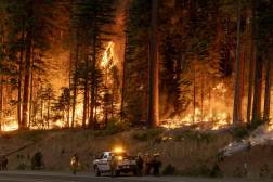
According to the National Interagency Fire Center, there have been more than 25,000 wildfires in the United States this year, burning more than 1 million acres. This is compared to just 10,000 fires that burned 1.8 million acres last year, and 15,000 fires that burned nearly 500,000 acres in 2023, including the devasating Maui fires.
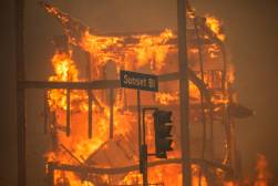
The 2024 figure includes the complex wildfires currently raging in northern Minnesota, which have burned over 30,000 acres, forcing Gov. Walz to issue several executive orders, as well as the January wildfires that burned over 57,000 acres in Los Angeles County.
Collins said satellite systems that collect wildfire data, such as NASA’s Terra and Aqua satellites, which provide updates every 12 to 24 hours, are often slow, outdated or inaccessible, especially in rural or under-resourced regions.
As wildfires grow faster, hotter and more destructive, emergency responders are racing against time, and he sees the urgency in delivering actionable data.
“We’re not here to change how fire departments operate,” Collins said of the Alliance’s role in emergency management. “We’re here to feed them high-quality geospatial products they can plug right into their existing systems. The quicker we can get our data out, the more lives, structures, and landscapes we can protect.”
Bringing in government agencies
FireSat’s sensors will detect significantly more fires, including smaller, previously undetected burns, than earlier systems. As a result, Collins said he expects the satellite’s data volume to be massive, prompting collaborations with AI and machine learning communities to create new tools and generate new insights for wildfire mitigation.
The Earth Fire Alliance has launched an early adopter program that includes the California Department of Forestry and Fire Protection, several Australian fire agencies and others in the Mediterranean and South America. Collins said each region brings unique administrations that help Earth Fire calibrate and adapt its tools.
“And the goal is anybody could then look at that early adopter group and find [a region] that’s like them. They could say, ‘Ah, my climate is much like this climate or that climate,’ so we can uplift parts of the United States that may not have really thought about the effects of wildland fire, but they can learn in the event they do have severe wildfire,” Collins explained.
CAL Fire Deputy Chief Marcus Hernandez said the constellation will improve how firefighters and emergency agencies respond to wildfires in California by providing real-time data and advanced analytics to enhance situational awareness for firefighters and the communities they serve.
“This will give us updates every 20 minutes on the fire perimeter, fire progress. That’s a massive game changer,” said Hernandez, who works in the statewide fire agency’s Office of Wildfire Technology Research and Development.
Hernandez said that FireSat’s higher frequency of delivering wildfire perimeter data will allow firefighters to better track fire progression, intensity and proximity to at-risk communities.
“The public is going to be an end user. Our website that millions visit for updated information will potentially have these updated perimeters,” Hernandez said.
He added that the thermal and spectral data gathered will also feed advanced fire behavior models, which will not only inform tactical decision-making on the ground, but will also be free and open access, supporting smaller, under-resourced organizations around the world.
“This should be at no cost,” Hernandez said. “Just like NASA puts their products on the public website for anyone to utilize, these products will be made publicly available for anyone to use.”
Monitoring climate trends from space
In addition to enhancing wildfire response and increased data, the FireSat satellite system is also poised to reimagine wildland fire tracking for climate scientists. Brian Buma, a researcher at the Environmental Defense Fund, an advocacy group, said the satellite offers researchers real-time insights into fire behavior and climate trends.
“FireSat is a step change — we’ll have an incredible increase in our spatial and temporal resolution,” said Buma.
Buma said the fine-grained visibility offered by the satellite could also improve scientific modeling and front-line wildfire mitigation. He said FireSat’s ability to detect the intensity of a fire offers critical insights into emissions and ecological damage.
“The more intense the fire, the more carbon emissions it generates. And intensity also tells us a lot about how that fire is going to impact the ecosystem,” Buma said.
Beyond tracking active fires, Buma added that the satellite will allow state and local agencies to be more proactive with fire management — such as deciding where to thin forests, conduct prescribed burns or invest in home hardening policies in high-risk areas.
“I’m hoping this data helps us make better decisions about where we guide new buildings, how we place fire treatments, and when to let fires burn versus when to intervene,” Buma said.
Buma said FireSat is also expected to provide insight into under-researched fire types, such as overwintering fires in boreal forests like in northeast Minnesota, or peat fires in the tropics — both significant carbon emitters.
“We really don’t know the contribution of small fires to global fire emissions. FireSat will give us a much clearer picture,” Buma said.
The project aims to bridge the gap between climate science and on-the-ground action, he said, giving federal agencies and first responders tools to reduce wildfire damage and greenhouse gas emissions.
“We can’t predict exactly where a fire will start, but we can build much better models to plan for when it does,” Buma said.