Michigan hopes moving GIS data to cloud increases flexibility, lowers storage costs

As Michigan’s IT department starts moving its geospatial imagery data to the cloud, GIS leaders are hoping to capitalize on the change to give state workers more flexibility and cut storage costs.
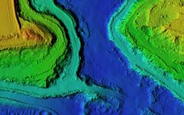
The state’s Department of Technology, Management and Budget struck a deal with GIS software provider Esri late last month to move 25 terabytes of image data into the company’s cloud. The department’s Center for Shared Solutions currently maintains the data, which covers aerial photographs adjusted to a uniform scale and survey data collected by technology that measures distance by illuminating a target with a laser light (known as “LiDAR”).
Mark Holmes, the department’s geospatial services manager, told StateScoop that the new system will be able to handle more “concurrent users” and let employees access the data remotely wherever they are. With more workers clamoring for the chance to study this information, Holmes felt the move was essential.
“Whether it’s at the desktop for users in the office or out in the field, we continue to see growth in geospatial across the different departments here,” Holmes said. “We needed a system that could really publish out these image services to the different devices within the office or out in the field.”
Holmes noted that the department started searching for a new way to manage the GIS data roughly a year ago. But with such a sizable amount of data to store, and complex demands from the people who use it, he said they had to be careful about what system they ultimately chose.
“We were looking for a new solution that had a combination of functionality and the efficient storage of the data,” Holmes said. “That’s where the Esri solution provided the best value between the two, leveraging their managed services from a storage perspective and lower costs there, reducing the duplication of having to store the same imagery multiple times for different products.”
Indeed, Holmes thinks the new system will cut down on load times for people using the data in the field as well as shrink costs for storing the same datasets over and over again.
“This allows you to basically load the imagery once and serve it up many times, rather than having to load the same imagery in different ways, like we did in the past,” Holmes said. “So the new technology saves storage costs there as well.”
With all the information now readily available in the cloud, Holmes also notes the new system “provides data on the fly,” letting workers play with the data sets without having to head back to the office to do so.
“That could be used for viewing the imagery and doing the analysis with it, doing different band manipulation for analysis of looking at vegetation, other types of ground features by manipulating the different color bands on the imagery,” Holmes said.
[Read more: Hawaii revamps GIS systems to improve access to accurate geographic data]
The image data might seem highly technical, but Holmes noted that it’s a “key foundational element” for all of the state’s GIS and mapping efforts.
“The imagery is key to the data maintenance of the other GIS layers that go on top of it,” Holmes said. “Be it roads, be it address structure locations, managing any types of boundary or land feature elements out there, continuing to have the imagery from the aerial photography and getting it in a system that can get it out to all the state employees to help do their job to continue to update their data and maintain it, that’s really a foundational piece to Michigan GIS.”
But he also cautioned that the state isn’t quite ready with the new system just yet.
“We’re in the process of loading the original imagery into the new system right now,” Holmes said. “We’re looking at fall in terms of having this up and going. End of summer, early fall.”
Once the department successfully moves all the data to the cloud, Holmes doesn’t see that as the end of the new system’s benefits. He notes that the state is constantly generating both LiDAR data and new aerial photographs, and will push those datasets to the cloud moving forward.
“It’s definitely not something that will be stagnant in terms of the imagery, it’s going to be updated,” Holmes said.
Thanks to the system’s “scalability,” he doesn’t foresee that process causing any consternation down the line.
“The system provides for future growth, so we’re not necessarily having to forklift anything out in the future,” Holmes said. “If we need to add to the managed services, additional server capacity, we can. The storage space is expandable that way.”


