People wait in line as free food is distributed to residents in need at a weekly food bank at Our Lady of Refuge Church in Brooklyn on February 28, 2024 in New York City.(Spencer Platt / Getty Images)
Proposed cuts to food assistance threaten not only to harm food-insecure people, but deprive food banks of valuable data they need to serve their communities.
Kern County, California, Deputy Fire Chief Zachary Wells and Esri's Ryan Lanclos say ALERTCalifornia's new map layer strengthens emergency management and improves community safety.
Milwaukee County recently updated its vehicle collision dashboard to include data on crash "hotspots," with the aim of driving improvements in public safety.
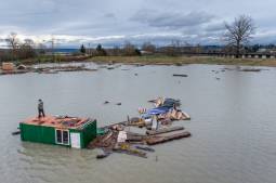
An aerial view of destroyed and cleared properties with vegetation regrowth on year after the Lahaina wildfire on August 6, 2024 in Lahaina, Hawaii. August 8 marks the one-year anniversary of the Maui wildfires which killed 102 people and devastated the historic community of Lahaina in West Maui. Plaintiffs involved in the Lahaina wildfire lawsuits against the government and utilities have reached a $4 billion global settlement of claims. (Mario Tama / Getty Images)
Staff at the Hawaii State Energy Office said that a critical decision-making tool that helps the state respond to and plan for emergencies may not have happened…
States are making steady progress on GIS and facing old challenges, according to the latest report from the National States Geographic Information Council.
After developing an extensive geospatial data warehouse, South Carolina broadband officials say they're better able to help the state allocate broadband funding.