Washington state’s mapping tech accelerated infrastructure recovery during December floods
When unprecedented floods last month struck 13 counties across Washington, the state’s geographic information systems proved to be an essential tool, helping emergency managers turn satellite, drone and agency data into actionable maps.
At the state’s emergency operations center, which was activated its highest level (Level 1), Washington Technology Solutions, the state’s technology department, served as the hub for geospatial data during the disaster. The department, which also goes by the name WaTech, helped coordinate recovery efforts across transportation, social health services, agriculture and natural resources departments.
Analysts used Geoportal 2, an app that provides access to national and municipal spatial data, and combined FEMA flood depth models with the state’s 911 address database to flag homes most likely to suffer major damage from the storms.
“It went very quickly,” Joanne Pearson, the state’s geographic information officer said in a press release outlining the coordinated effort. “They very quickly escalated from monitoring to a it’s an all 24/7 type of response.”
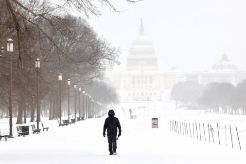
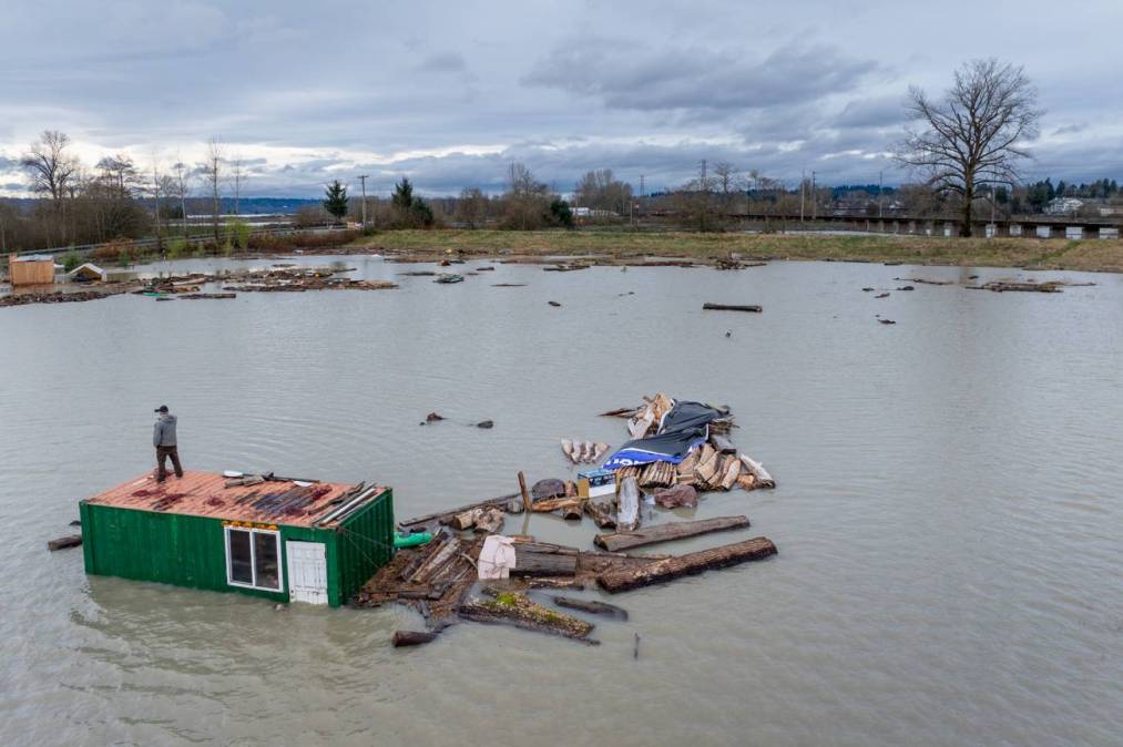
Between Dec. 5 and Dec. 22, a series of intense atmospheric rivers and winter storms caused widespread flooding, landslides, high winds, power outages and severe damage to homes and critical infrastructure across the state. More than 100,000 people were under evacuation orders, 383 emergency rescues were conducted, one person lost her life and nearly 4,000 homes were damaged.
The severity of the destruction prompted Gov. Bob Ferguson to send President Trump a letter last week requesting a major disaster declaration and $21.3 million in assistance from the Federal Emergency Management Agency.
“The scale, duration, and severity of this disaster overwhelmed local and state response capabilities,” Ferguson said in statement last week about the request. “Thousands of families experienced devastating loss. Federal assistance is essential to help Washingtonians recover from these historic floods.”
The Washington state government’s response, which build on years of increasing geospatial data sharing across agencies, reflects a broader trend among states to further embed GIS into emergency management and public service delivery operations.
During the COVID-19 pandemic, Maryland used GIS to track the spread of the virus across the state. In 2022, the Montana State Library used statewide GIS data to help improve, route and dispatch emergency services.
Several states have established GIS councils and other governance structures to improve data-sharing and coordination. Arizona’s Geographic Information Council sets statewide standards, while regional efforts, such as the Central United States Earthquake Center information-sharing platform, help neighboring states collaborate during emergencies.
Yet progress isn’t uniform. Some state officials note that GIS remains underused in some places and by some agencies, due to data silos and uneven technology investment.