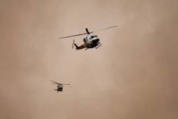
The Cal Fire Aviation Tracking and Information System is the state's latest effort to improve its firefighting management systems after last January's devastating Los Angeles blazes.
Kern County, California, Deputy Fire Chief Zachary Wells and Esri's Ryan Lanclos say ALERTCalifornia's new map layer strengthens emergency management and improves community safety.
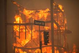
Flames from the Palisades Fire burn a building on Sunset Boulevard amid a powerful windstorm on January 8, 2025 in the Pacific Palisades neighborhood of Los Angeles, California. (Apu Gomes / Getty Images)
Marcus Hernandez, a California deputy fire chief who leads the Office of Wildfire Technology Research and Development, shares how new technologies enter the field.