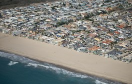
Oxnard, CA – October 05, 2026: Oxnard Shores photographed from an airplane on Monday, Oct. 5, 2026 in Oxnard, CA. Topographic LiDAR survey of the California coastline funded by the state of California monitors coastal erosion and morphology due to increasingly large storm and weather events along with rising sea levels. This survey serves as a baseline for future surveys and was conducted just before and after an active El Nino winter season.(Kayla Bartkowski / Los Angeles Times via Getty Images)
The National Oceanic and Atmospheric Administration has forecasted a 75% chance that this year’s El Niño will become a historic event, increasing the risk of high tide…
As the water level starts to drop, drivers make their way through flash flooding caused by a monsoonal thunderstorm that quickly dropped three inches of rain on a region still recovering from Tropical Storm Hilary on September 1, 2023 in Thermal, California. Less than two weeks earlier, Tropical Storm Hilary, which had been a hurricane off the west coast of Mexico, brought flood damage to the Southern California desert region. (David McNew / Getty Images)
Ahead of a potentially intense winter storm season, California's emergency response departments are adopting new ways to protect communities and their residents.
In a move to bolster its defenses against this winter's El Niño storms, Los Angeles last week unveiled an interactive map that allows users to receive up-to-the-minute…