
Advertisement

Landslides

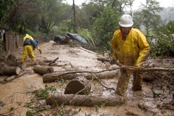
FAIRFAX, CA – JANUARY 2: Gilbert Velarde clears debris from a mudslide on Tamalpias Road January 2, 2006 in Fairfax, California. Northern California has been inundated by heavy rain over the past week, causing mudslides and pushing rivers over their banks. (Photo by David Paul Morris/Getty Images)

States look to lidar, machine learning and satellites to map landslide risks

New federal grants from the U.S. Geological Survey are helping states build landslide databases that can improve hazard mapping, emergency planning and public awareness.
Advertisement
Advertisement